Virginia Meissner Sno-Park
Nordeen Shelter
Hike details:
Mileage: 1.2 mile loop w/ 220 ft. elevation gain
Approximate hike time: 40 minutes w/ an average pace of 1.8 mph
Difficulty: Easy but very steep!
Trail usage: High on weekends, low on weekdays
Highest elevation: 5,660 ft. Lowest elevation: 5,400 ft.
General location: 13.5 miles southwest of Bend - Deschutes National Forest
Suggested seasons: Winter
(Best time to go is January & early February for best snow conditions).
Permits required: Sno-park pass is required from November 1 - April 30
Pit toilet at trailhead: Yes
Trail allows: Snowshoes, cross-country skis. DOGS ARE NOT ALLOWED HERE!
Possible dangers: N/A
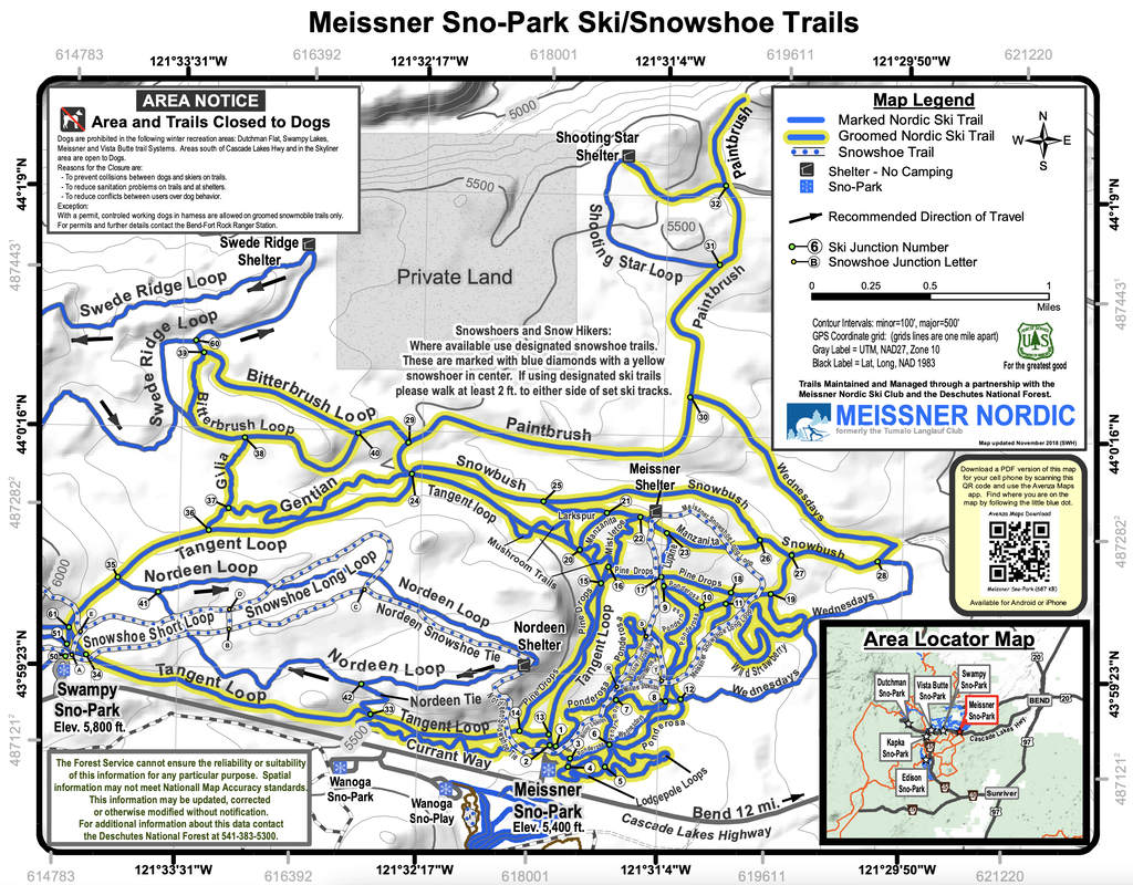
(Click on the map to get the PDF)
Description:
Virginia Meissner sno-park is the closest sno-park to Bend and it has miles and miles of cross-country ski and snowshoe trails. The beauty of this particular sno-park is that it has designated groomed cross-country ski tracks and separate trails for snowshoers. This causes less friction between the two outdoors sports. A reminder, there are also no dogs allowed at Virginia Meissner.
If you are here to snowshoe, there are a bunch of awesome loops and out and back trails you can go on. There is a large map of all the trails posted by the parking area, or you can download the PDF onto your phone before heading out. Virginia Meissner sno-park is close enough to Bend that it does have about 2-3 bars of phone service (depending on the weather).
If you are here to snowshoe, there are a bunch of awesome loops and out and back trails you can go on. There is a large map of all the trails posted by the parking area, or you can download the PDF onto your phone before heading out. Virginia Meissner sno-park is close enough to Bend that it does have about 2-3 bars of phone service (depending on the weather).
|
|
|
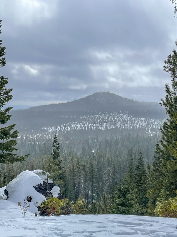
The trail to Nordeen Shelter is one of shorter trails at Virginia Meissner Sno-Park, but it is definitely one of the more difficult routes. Even though you are only gaining 220 feet of elevation, it feels incredibly steep on snowshoes, and heel lifts are really nice to have.
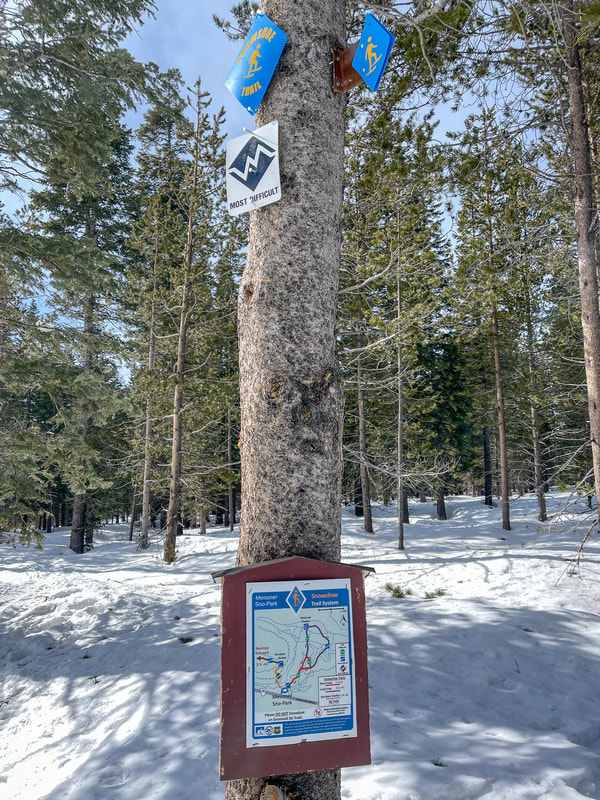
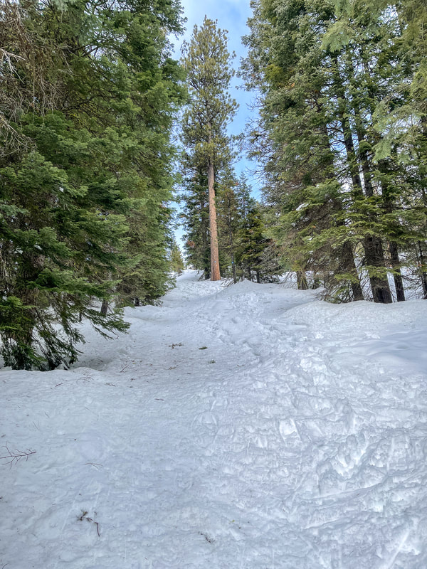
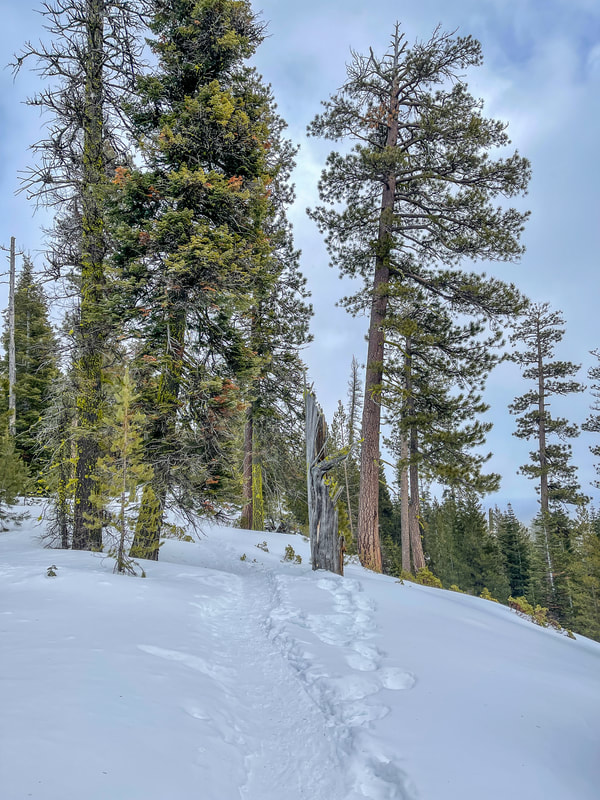
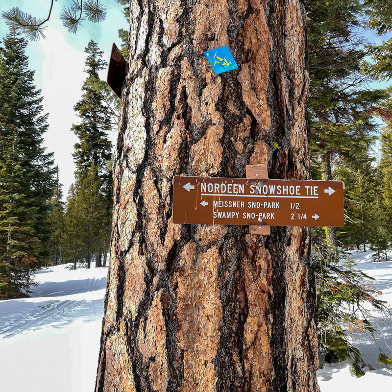
This trail starts on the west side of the sno-park and it is marked with a map and a blue snowshoe diamond. The black marker on the tree signifies that this is a difficult trail. The first 0.2 miles of this trail are very easy and the trail takes you across a flat area and through some trees. After you cross a groomed ski track, you will start going steeply up a hill. After gaining the majority of the 220 feet of elevation in just 0.2 miles, the trail evens out and starts heading northeast along a ridge, where on clear days you can catch some views towards Bend. After another 0.2 miles you will reach a beautiful viewpoint and Nordeen Shelter. If you want to do a longer snowshoe trek, you can opt to do the Nordeen Loop, which is a total of 3.25 miles long and there are signs on trees near the shelter. The rest of the loop is fairly tame compared to this first part which was very steep. If you are just doing the 1.2 mile out and back, enjoy a snack and the view at Nordeen Shelter and then head back the way you came. |
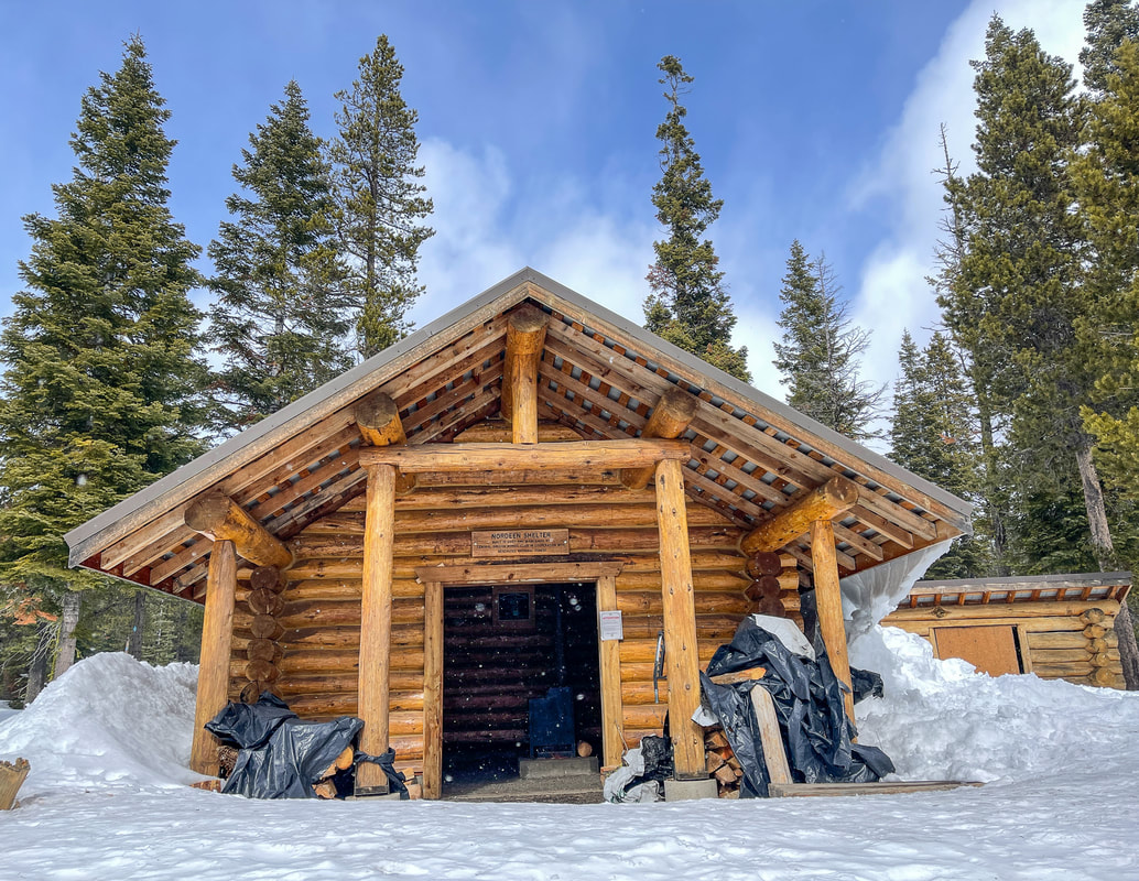
(Nordeen Shelter)
|
Virginia Meissner Sno-Park has a lot of awesome trails, and because it is so close to Bend, it gives you an option to get outside in the woods for a quick snow-shoe or cross-country ski trek, even if you have a busy day and have to get back to town early. If you are visiting Bend, on the way back into town, don't miss stopping by Sparrow Bakery and grabbing one of their famous croissant sandwiches and an Ocean Roll.
|
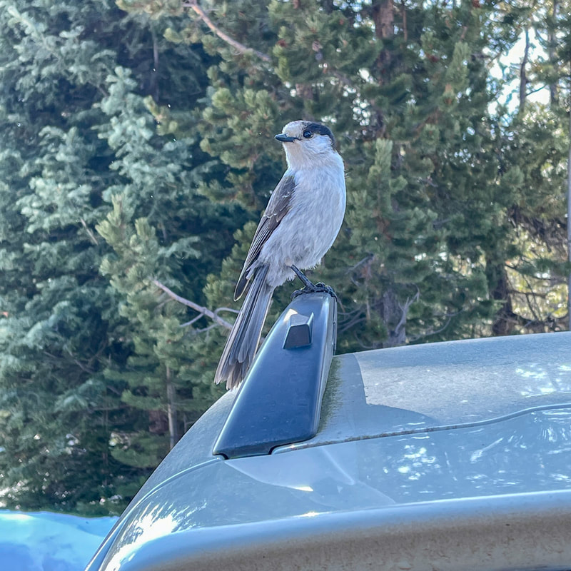
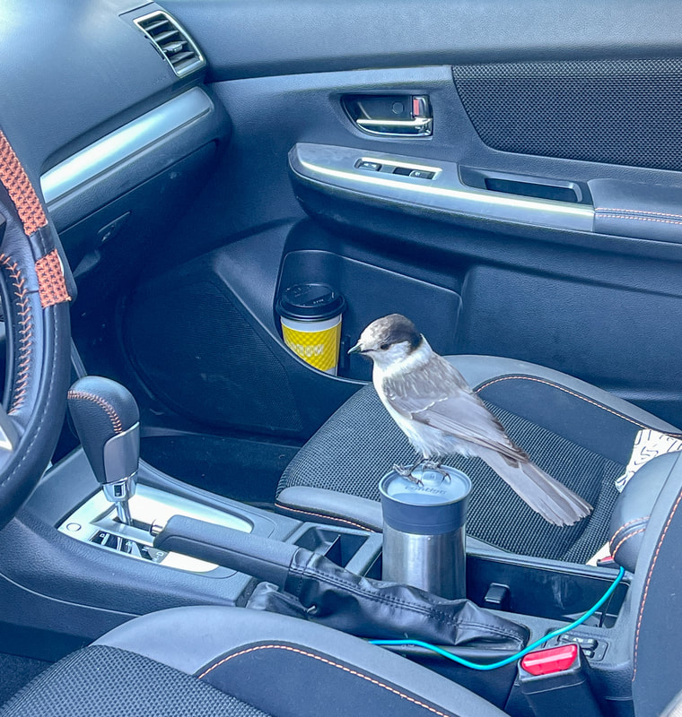
Pro tip: Be careful when you're putting your gear into your car at the snow-park parking area. The grey jay birds are very curious and they try to scavenge any bit of food they can. They will even fly into your car, picking crumbs from your floor board if they get the chance to. So don't leave any food out for them to grab, and keep your car doors closed if you can.
|
|
Directions:
From Bend
- Drive SW Century Dr. (which then becomes the Cascade Lakes Highway) for a total of 13 miles, then turn right at a sign for Virginia Meissner Sno-Park. (Total of 13 miles)
- Total of 142 miles via Bend.
- Total of 145 miles via Bend.
- Total of 189 miles via Bend.
- Total of 178 miles via Sunriver and NF-45.
-This trail write-up was last updated February 2022-
*All pictures are taken by Franziska Weinheimer
*All pictures are taken by Franziska Weinheimer
*Disclaimer: The trail descriptions, mileage, GPS tracks and difficulty ratings depicted on this website are never 100% accurate. Always hike at your own risk, using your own knowledge, equipment and common sense. Franziska Weinheimer/Hike Oregon are not responsible if you or anyone in your party gets injured or lost while attempting one of these or any other hikes.