Eagle Creek Trail
Hike details:
Mileage: 4 miles round trip w/ 525 ft. elevation gain (to Punchbowl Falls)
13.1 miles round trip w/ 1,424 ft. elevation gain (to Twister Falls)
26.6 miles round trip w/ 3,910 ft. elevation gain (to Wahtum Lake)
Approximate hike time: 1 hour 44 minutes w/ an average pace of 2.3 mph (to Punchbowl Falls)
5 hours 41 minutes w/ an average pace of 2.3 mph (to Twister Falls)
11 hours 33 minutes w/ an average pace of 2.3 mph (to Wahtum Lake)
Difficulty: Easy to difficult (depending on how far you go)
Trail usage: High
Highest elevation: 3,758 ft. (Wahtum Lake) Lowest elevation: 107 ft. (trailhead)
General location: 40 miles east of Portland - Mark O. Hatfield Wilderness - Mount Hood National Forest
Accessible: March through November
(Best time to go is mid-May through mid-June for an abundance of wildflowers and powerful waterfall flow).
Permits required: Free self issue wilderness permit June 15 - October 15 available at the wilderness boundary (around 5 miles into the hike)
Northwest Forest Pass for parking
Pit toilet at trailhead: Yes
Trail allows: Dogs, camping
Possible dangers: Steep cliff drop offs, slippery trail, landslides, the parking lot is known for car break-ins.
|
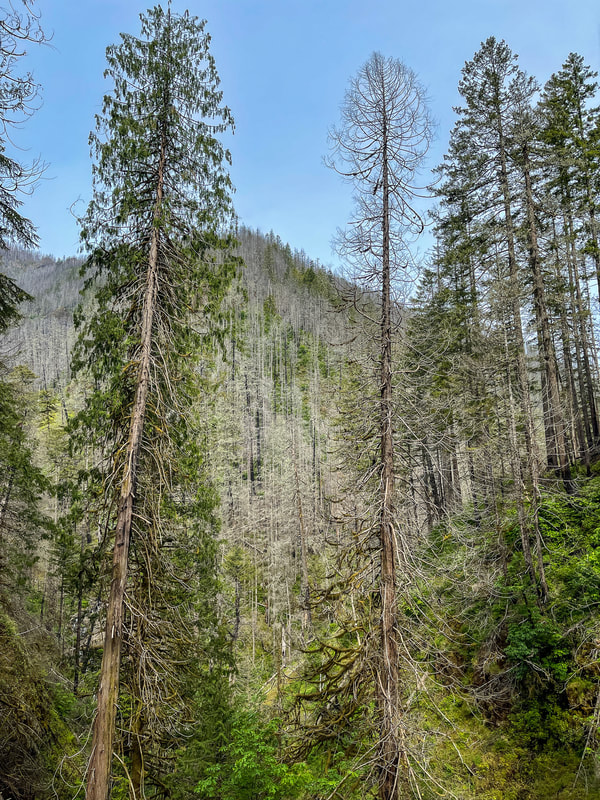
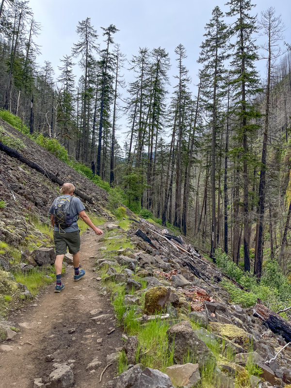
Description:The Eagle Creek Trail has always been a beloved gem of the Columbia River Gorge. Unfortunately in 2017 a human caused wildfire torched the trail and burned about 50,000 acres of surrounding old growth forest. The damage from this fire is pretty severe and has changed the Eagle Creek Trail a lot. However, after over 5 years a lot of greenery has come back and the wildflowers that bloom along this trail now are incredible in late May/early June. The trail is lush and green again since a lot of ferns and moss have come back, but there still many burnt and blackened trees along the trail. It doesn't matter whether it is a weekday or weekend, this trail is extremely popular with Portland area locals, so the parking lot tends to to get quite full after about 9-10am, so it is suggested to go as early as you can. Also make sure to leave absolutely nothing visible in your car, or even leave your car unlocked as this trailhead is notorious for car break-ins.
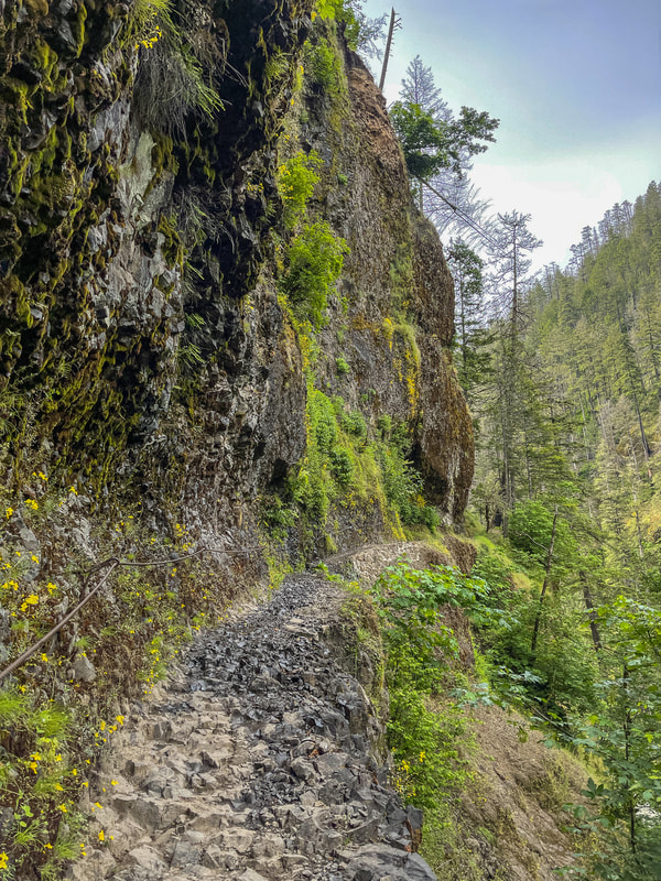
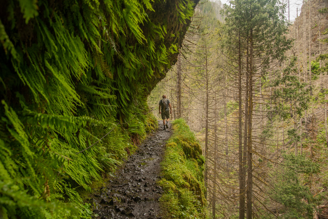
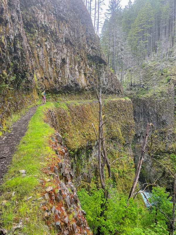
The trail is narrow, hugging the cliffside much of the time. During times of heavy rain landslides tend to happen which can block the trail. This happens at least a few times during the winter and spring, so keep an eye on the Forest Service page to make sure the trail is open before you go. After about 0.8 miles, the trail turns quite rocky and is cut in the side of the rock. There are cables to hold onto and the drop off down to the creek is sometimes up to 150 feet. After 1.7 miles you will come to where there is a little trail that goes down to the edge of the water and the bottom of Punchbowl Falls, however sometimes the water is quite high and doesn't make this side trip worth it. |
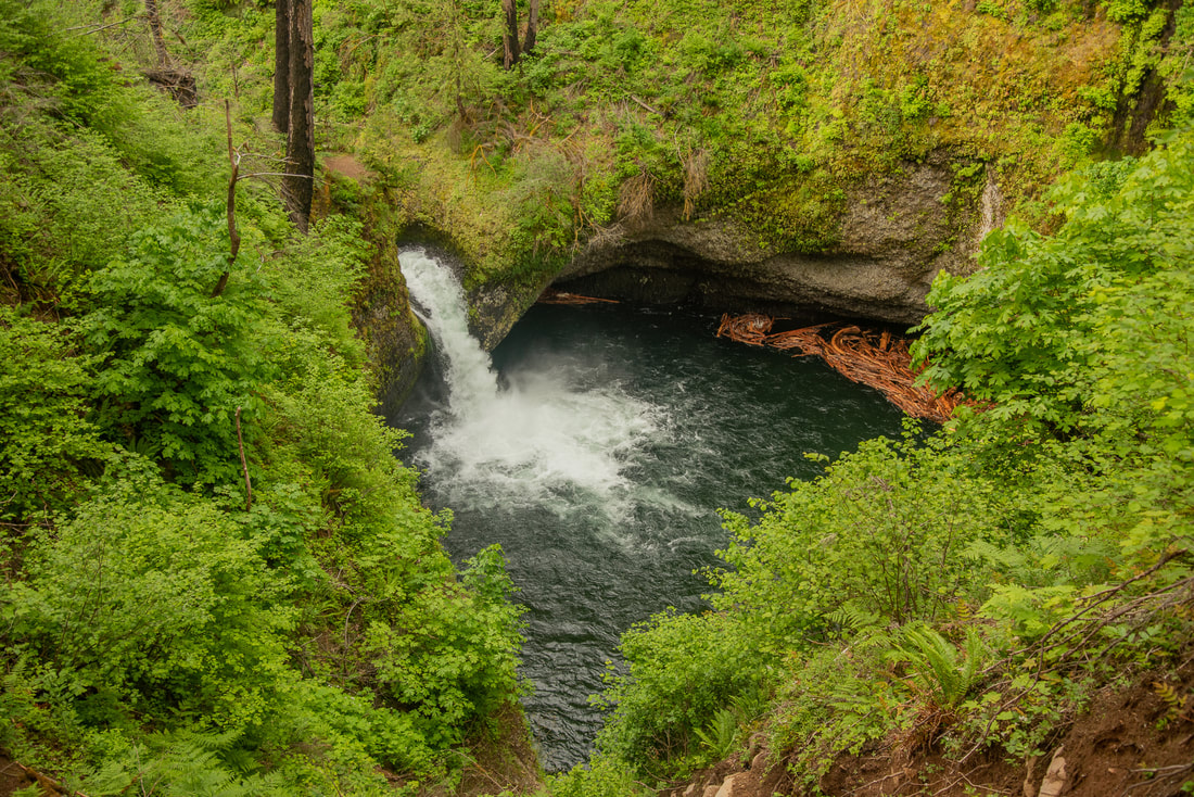
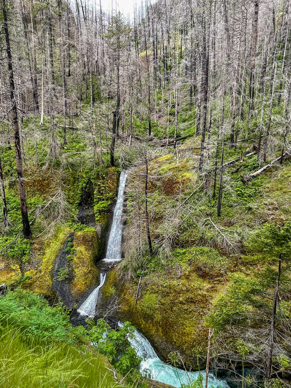
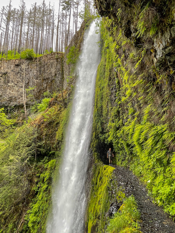
(Punchbowl Falls - 36 feet)
|
|
After 1.9 miles you will come to the Punchbowl Falls overlook where you can see the falls from above. After checking out the falls, the trail is a little bit more tame and has less steep drop offs, as it travels through the burnt forest. At mile 3.1 you will see 88-foot tall Loowit Falls, one of the coolest waterfalls on this hike (in my opinion). 0.1 miles after seeing Loowit Falls, the trail crosses the creek via High Bridge. Now you are on the other side of the creek for the next half mile.
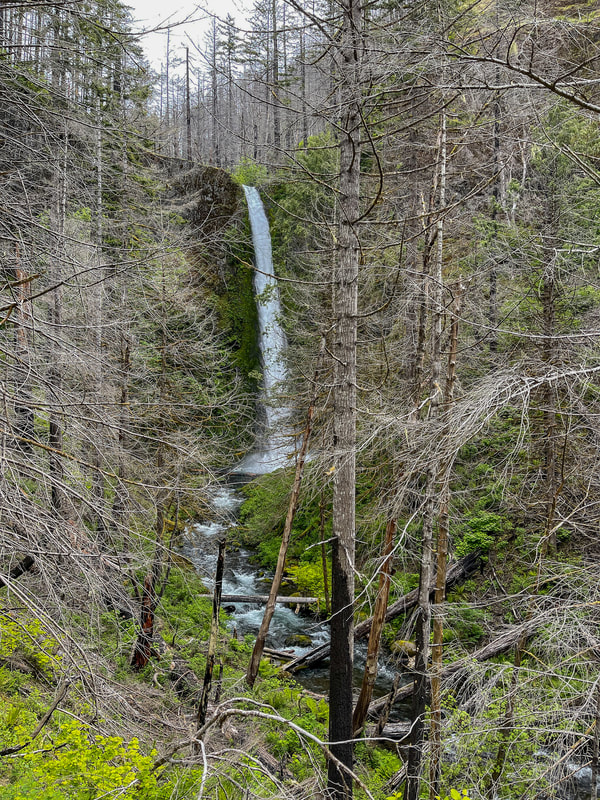
(Loowit Falls - 88 feet)
|

|
|
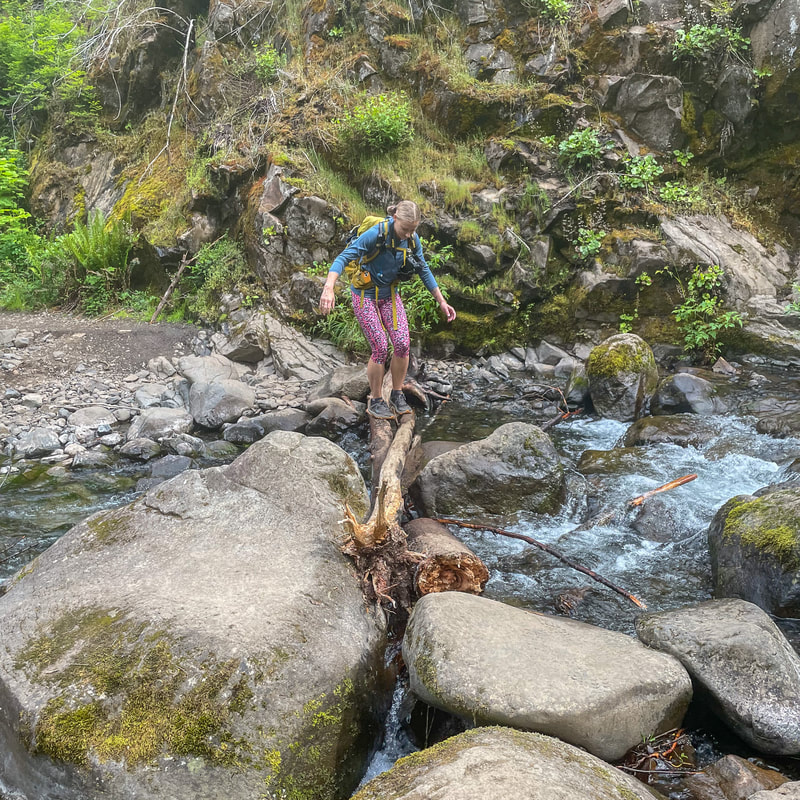
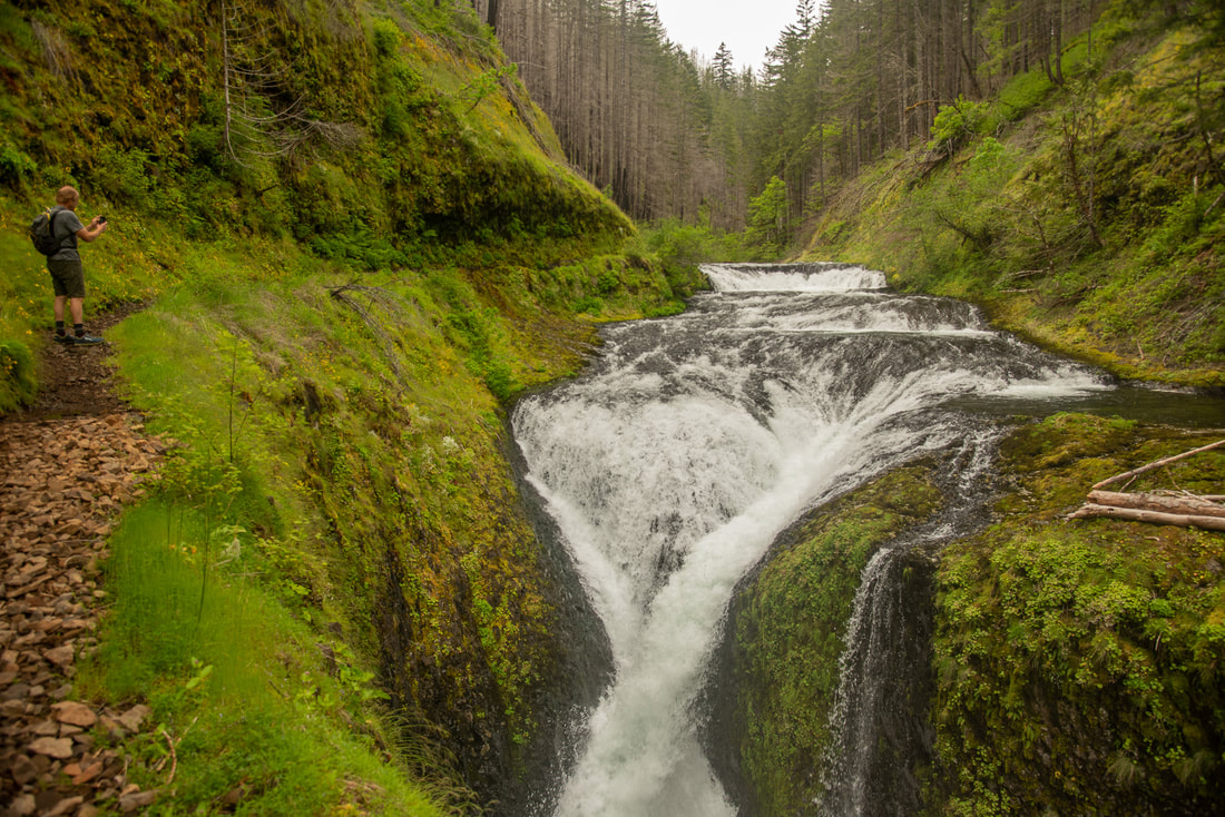
At 4.6 miles you will see Wy'est Camp, one of the many designated campsites along this trail. Many people backpack all the way up to Wahtum Lake, which is a total of 13.3 miles one way, so most people camp along the way. At 4.8 miles you will cross Wy'east Creek on logs/rocks and you will see impressive 157-foot tall Wy'east Falls to your left. At 5.1 miles you will pass Blue Grouse Camp and at 5.7 miles you will see Grand Union Falls, which is not very tall but very beautiful.
|

(Wy'east Falls - 157 feet)
|
(Grand Union Falls - 41 feet)
|
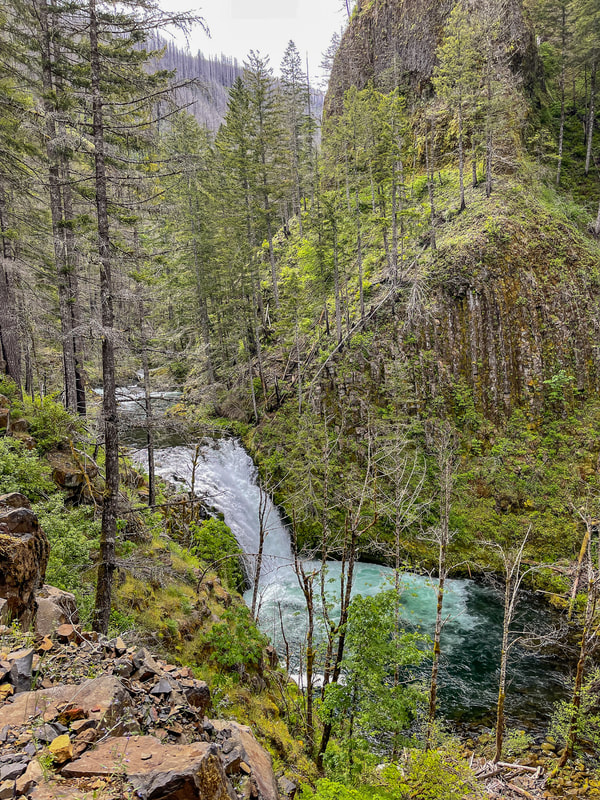
Right after seeing Grand Union Falls, the trail rounds the corner and you will see the famous Tunnel Falls. Tunnel Falls is a whopping 172 feet tall and the trail goes through a tunnel behind the falls. This is such a cool experience. Once you come out of the tunnel, the trail hugs the incredibly steep cliffside with a _ drop off. If they're not backpacking to Wahtum Lake, most people turn around at Tunnel Falls, however this means they miss Twister Falls, which is only 0.25 miles further down the trail.
(Tunnel Falls - 172 feet)
|
|
|
Twister Falls is really cool and definitely worth seeing. There are some flat spots to take a lunch break at the falls before heading back. If you are continuing to Wahtum Lake, you will see two camp spots before the trail switches back and begins to head steeply uphill. 2 miles before Wahtum Lake there is another campsite called Upper Eagle Creek Camp. Wahtum Lake is very beautiful and can also be accessed from Wahtum Lake Trailhead. Keep this in mind, especially on weekends since there are limited campsites at the lake.
The Eagle Creek Trail is extremely popular and for good reason. You will see lots of waterfalls, in May/June you will see an abundance of wildflowers, and the moss and ferns on the cliffside rocks creates a magical feel. Make sure to get to the trailhead early if you want a parking spot, and even though dogs are allowed on the trail, keep it in mind it's narrow and there are steep drop offs, so it might not be the best idea to take your furry friend on this hike. The trail is rated as difficult due to the mileage to Twister Falls and Wahtum Lake. Much of the trail is pretty rocky, which can be slippery when it's rainy, and it can definitely make your feet hurt a bit if you don't have the proper footwear. If you want to do a shorter and much easier hike, consider just hiking to Punchbowl Falls, which is a total of 4 miles and very doable for a quick easy day hike. |
(Twister Falls - 148 feet)
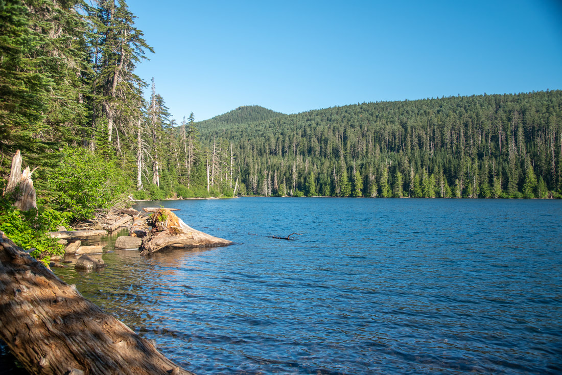
(Wahtum Lake)
Directions:
From Portland
- Drive east on I-84 for about 30 miles. Take exit 41 toward Fish Hatchery/Rec. Area/Eagle Creek.Turn right onto NE Eagle Creek Ln. and follow this road to the parking area at its end. The parking can get extremely fully after 9-10am even on weekdays. (Total of 30-40 miles depending on where in Portland you are coming from).
- Drive north on US-97 towards Redmond and Madras. In Madras merge left onto US-26 and stay on this highway for 100 miles. In Troutdale merge right onto I-84 towards Hood River for 14 miles then exit at the sign for Multnomah Falls. (Total of 168 miles)
- Total of 86 miles.
- Total of 150 miles.
- Total of 313 miles.
-This trail write-up was last updated December, 2022-
*All pictures are taken by Franziska Weinheimer
*All pictures are taken by Franziska Weinheimer
*Disclaimer: The trail descriptions, mileage, GPS tracks and difficulty ratings depicted on this website are never 100% accurate. Always hike at your own risk, using your own knowledge, equipment and common sense. Franziska Weinheimer/Hike Oregon are not responsible if you or anyone in your party gets injured or lost while attempting one of these or any other hikes.